NEPTUNE Navigation Software +44(0)118 988 5309
Tides UK & European
(PC and Windows tablet)
Version 9.3
Easy and quick program producing Instant
graphs, showing exactly what rise of tide is
predicted at any chosen date, time and port.
Next day? Just click! Monthly tables can be
viewed or printed.
No updates required Predicts until 2060.
£24.95
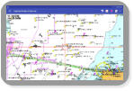
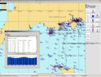
Wrecks, Tides & Streams
(PC and Windows tablet)
New Version 11
Invaluable program for all enthusiastic
Divers, Dive schools and Instructors.
The software provides a dynamic Tidal
Stream atlas instantly updating and
producing Slack, Flood and Intermediate
reports for optimising dive times.
Thousands of UK Wrecks and Obstructions
are available with details of depths, history,
cargo and many other details ideal for
planning dives.
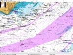
Charts with tidal data derived from UKHO
sources.
£59.00
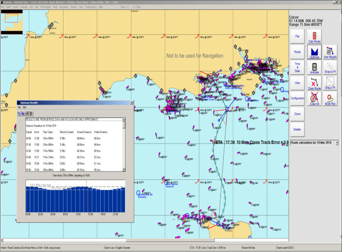
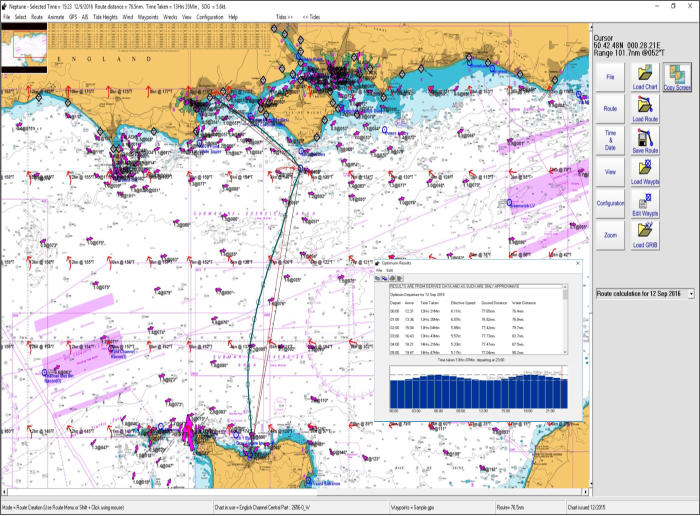
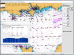
Passage Planning Software
(PC and Windows tablet)
Version 11.1.5
Plotting and Passage Planning tidal
navigation program offers Course
Calculations from inbuilt Tidal Data and
Wind Routines producing Course to Steer,
Course Over Ground and Optimised
Departure. GPS Track Plot, AIS, Waypoint
Manager. Incorporates a Tide Height
Program. Grib Files, Google Earth, Animate
Course Over Ground.
GPX Waypoint and Route compatibility with
other systems.
Navigation and Pilotage charts
derived from
UKHO sources, or
Imray Digital charts.
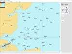
Planner Plus v11.00
£95.00 (including a chart portfolio)
A planning tool that contains all the
features of Planner Plus but uses
outline charts for clear overview.
Ideal for forward planning.
You can use it on board for displaying
boat position & AIS targets.
£69.00
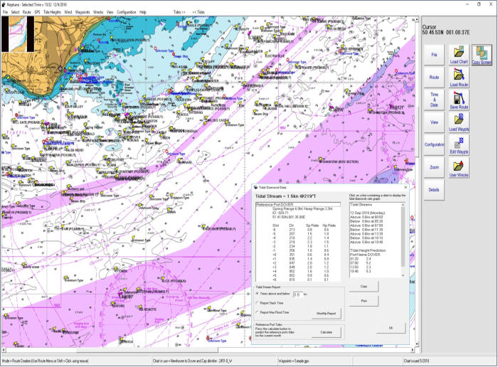
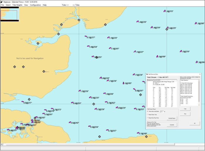
Tides & Tidal Stream
(PC and Windows tablet)
This comprehensive Tidal Stream and
Tides Height software offers animated
Tidal Streams using Outline Chart
cartography. Software incorporating
Neptune's Tidal Heights program.
£35.00


Neptune Navigation Software
Unit 11 Diddenham Court
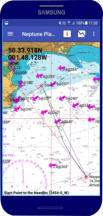
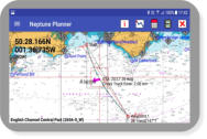
Neptune Planner app
Currently Unavailable - back soon
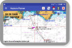
Install Neptune Planner on your Android
phone or tablet. Calculate the Course to
Steer and the Optimised Departure Time
from its built in tidal database (no need to
go on-line). See the Neptune Planner app
Neptune calculations are not time limited
and you can passage plan and predict tides
for now or for many years ahead.
With download charts you can easily obtain
the latest chart immediately prior to sailing.
Using Route animations you can virtually sail
your course to see cross track errors and the
effect of wind over tides on your intended
route. After a calculation you can easily
share your plans for SOLAS compliance.
From £18.49
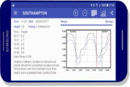
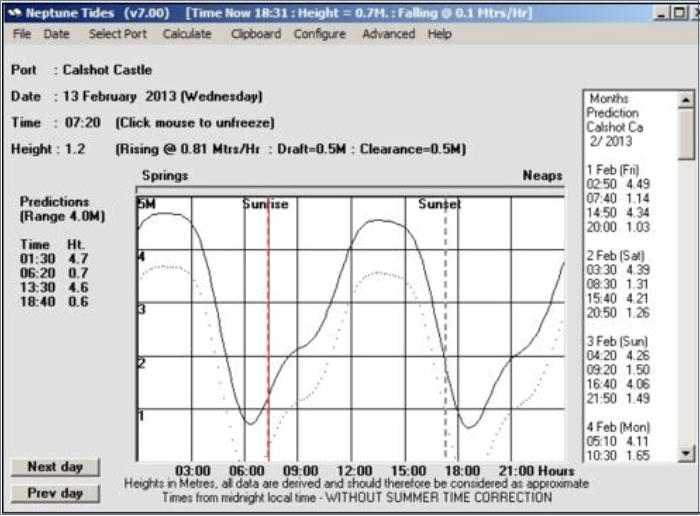
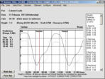
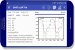
An easy to use tidal height prediction software
347 UK & 312 European ports. This software is
full of features, displays the daily curve,
instantaneous rate of rise or fall of the tide,
sun rise and set times, lunar phases,
springs to neaps indicator, monthly tide
times and heights.
£6.49
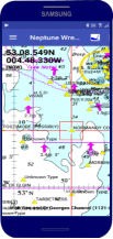
On your Android phone or tablet the software
displays the details of thousands of wrecks and
obstructions around our coastline.
Predicts tidal height and tidal stream details around
our UK coastline for many years into the future.
from £18.49


NEW


A fascinating program that plots
details of thousands of wrecks around
the UK waters. data derived from
UKHO sources provides depth, date
sunk, cargo and circumstances of loss.
Tidal navigation software for "Course
to Steer", "Best Departure Time" and
other passage planning tidal
calculations.
Many unique and exciting features.
Your tidal data does not time out!!
Quick and easy PC program
producing Instant tidal heights
showing exactly what rise of tide is
predicted at any chosen date, time
and port. Does not time out!!
This comprehensive Tidal Stream and
Tides Height software offers animated
Tidal Streams with Outline Chart
cartography. Software incorporating
Neptune's Tidal Heights program.
NEPTUNE Navigation Software +44(0)118 988 5309


A planning tool that contains all the
features of Planner Plus but uses
outline charts for clear overview.
Ideal for forward planning.
You can use it on board for displaying
boat position & AIS targets.
Neptune Navigation Software
Unit 11 Diddenham Court
Lambswood Hill Grazeley RG7 1JQ
tel: +44 (0)118 988 5309
On Android phone and tablet Course
to Steer and the Optimised Departure
calculations from tides, streams and
wind. Route animations. Download
charts to obtain the latest chart prior
to sailing.
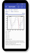
This software is full of features,
displays the daily curve, instantaneous
rate of rise or fall of the tide, sun rise
and set times, lunar phases, springs to
neaps indicator, monthly tide times.
Displays the details of thousands of
wrecks and obstructions around our
coastline.Predicts tidal height and tidal
stream details around our UK coastline
for many years into the future.