
Download Tides, Streams & Wrecks
Purchase Tides,
Streams & Wrecks
Tides and Tidal Streams
Tides
Planner Plus
Outline Planner
C-Map Planner
Site Map
Contact
Order
Terms and Conditions
Privacy
Home Page
Tides, Streams & Wrecks ...
£59.00
Includes a Portfolio of Charts
Additional
Portfolios ... £29.00
Complete
Tides, Streams & Wrecks
...
£129.00
Includes a full set of Portfolio of Charts
Club Tides, Streams & Wrecks
... £299.00
Includes a full set of Portfolio of Charts (Max. of 5 users)
Tides, Tidal Streams & Wrecks -
Program for Divers and
Anglers
An invaluable program for all enthusiastic Divers, Dive Schools and Instructors
Tidal Height Predictions
Instant graphs, showing exactly the rise of tide that is predicted at any chosen date, time and port.
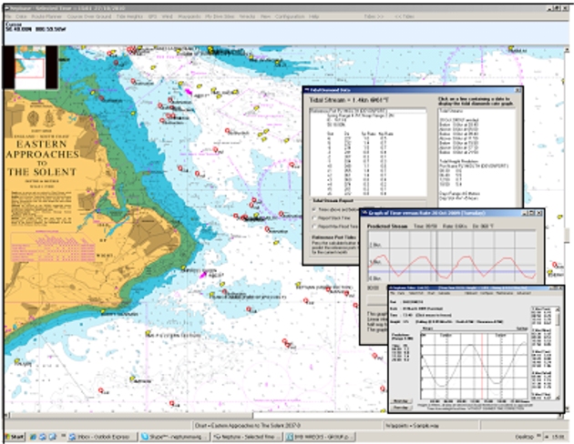
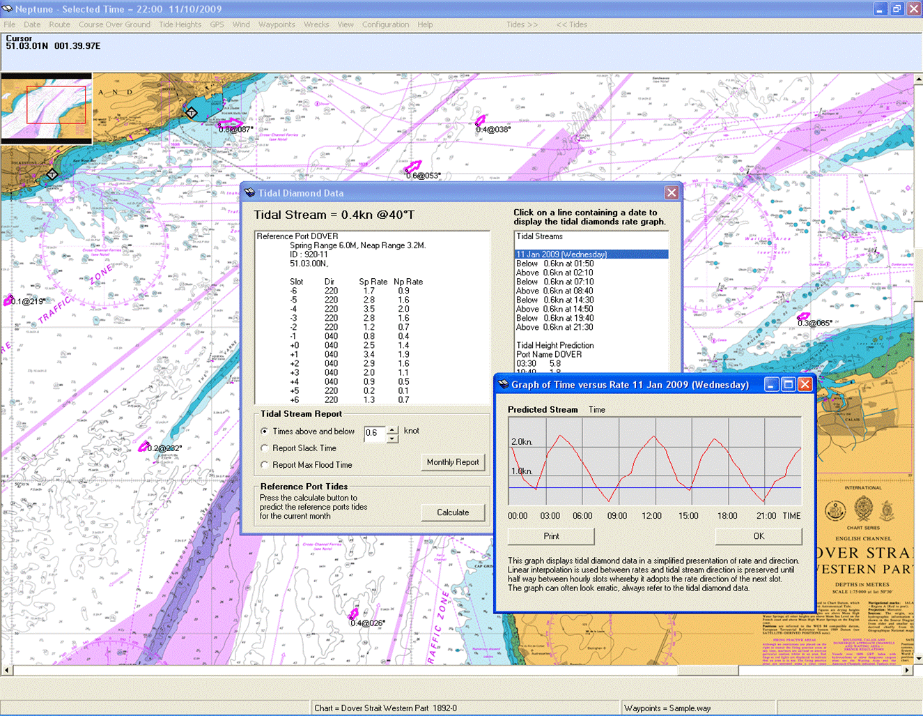
Tidal Streams
The software provides a dynamic tidal stream atlas instantly updating and
producing Slack, Flood and Intermediate reports for optimising dive times.
Wrecks and Obstructions
Details of thousands of UK Wrecks and Obstructions are available with
details of depths, history, cargo and many other details ideal for
planning dives.
Passage Plans
To assist with SOLAS compliance passage planning routines are included.
Charts
Charts and tidal data are provided by the United Kingdom Hydrographic
Office.
No annual updates required.
User Dive Site
Record details of your dive sites, also included is an Image Viewer for your photographs.
System requirements:
Windows XP, Vista, Windows 7, 8
The program manual is in HTML format.
Wrecks, Tides & Tidal Streams Area Portfolios
Scillies
to Solent
Solent to Dungeness
Dover Straits & Thames
East Coast
N Devon to South Wales
Wales
NW England & Irish Sea
West and North Scotland
Eastern Scotland
Ireland
![]() Buy Online
Buy Online
or call us on
+44 (0)118 988 5309
![]() Buy
Online
Buy
Online
or call us on
+44 (0)118 988 5309
FEATURES
Tidal Heights
Instantaneous Tidal Predictions
Tidal Streams
Wrecks & Obstructions
NEW FEATURE
![]() Grib Files for Internet Weather
Grib Files for Internet Weather